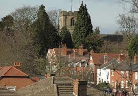
Medieval Northfield. 2.5mls approx, 50mins
Easy Access.
This city walk takes you to Medieval Northfield passing by the Medieval Church of St Laurence and goes past the River Rea and buildings of local interest.
Starting at the Focus Community Centre, Turves Green, Northfield B31 4BP.
[1] With your back to the community centre, turn right along Turves Green Road. Take your first right into Moor Park Road and follow the road around as it bears left. Before Moor Park Road turns back on itself, there is an alleyway between brown fences by No.44 Moor Park Road. Pass through this and continue right onto Turves Green Road.
[2] Cross the junction with West Heath Road, taking great care. Continue ahead into Staple Lodge Road, crossing Houldey Road. Following this, cross Staple Lodge Road and then turn left into Rea Valley Drive. After crossing Over Brunton Close and Old Bank Top, bear left into Bridge Piece. At the end of Bridge Piece, go through the barriers on the turning circle and turn right onto the surfaced path.
(A)This is part of the River Rea Heritage Trail which runs for 7 miles from Waseley Hills to Cannon Hill Park. It follows the Rea for roughly half its length before it flows into the Tame near Spaghetti Junction.
[3] After a few metres, cross the footbridge over the Rea and then turn left. The trail then reaches West Heath Road. Stay on the right hand side of West Heath Road. Continue uphill. At the lights cross to the left hand side as this is the only pavement under the railway arch. Cross over again at the other side of the arch. This is now Church Hill. Carry on along the road, crossing Woodland Road and passing an alley called ‘the Darkies’. You will soon come to (B)St Laurence Church on your right.
St Laurence Church is the oldest building in Northfield, with parts of the church dating from the Norman period. It is one of only three surviving Medieval churches in Birmingham; the other two are in King’s Norton and Sheldon. The Great Stone pub opposite the church used to be a ‘hall house’ in medieval times. The great ‘Stone’ of the pub’s name is a boulder left by the last Ice Age which now resides in the village pound next to the pub.
A detour straight ahead into Church Road takes you to the site of an alleged ghost sighting, of “Mrs Kelly”, in the early 1960s.
[4] Cross to the Great Stone pub and then with your back to the pub turn right to continue down Church Hill, keeping to the right hand side. You pass two cottages with steps to further buildings. (These cottages were built in the 19th Century, originally without water or sanitation. They drew their water from a communal pump.)
Now heading back downhill along Church Hill you will see two old Nailer’s Cottages. (Making nails was once a key industry in South Birmingham. Next to the cottage (the two were joined into one building in the 1950s) you can see a small outbuilding that used to house the forge. In the chimney of one you can see what used to be a tiled dovecote. )
Carry on down Church Hill, taking care as you cross the busy Pamela Road.
[5] Take the next right into Spinney Close and carry on through to Copse Close using the footway that joins the two. At the end of Copse Close turn left into Quarry Lane, and then left again into Coley’s Lane. At the end of Coley’s Lane take care when crossing Turves Green Road before heading right to get back to the community centre.
Tags:
